We use cookies to help you navigate efficiently and perform certain functions. You will find detailed information about all cookies under each consent category below.
The cookies that are categorized as "Necessary" are stored on your browser as they are essential for enabling the basic functionalities of the site. ...
Necessary cookies are required to enable the basic features of this site, such as providing secure log-in or adjusting your consent preferences. These cookies do not store any personally identifiable data.
Functional cookies help perform certain functionalities like sharing the content of the website on social media platforms, collecting feedback, and other third-party features.
Analytical cookies are used to understand how visitors interact with the website. These cookies help provide information on metrics such as the number of visitors, bounce rate, traffic source, etc.
Performance cookies are used to understand and analyze the key performance indexes of the website which helps in delivering a better user experience for the visitors.
Advertisement cookies are used to provide visitors with customized advertisements based on the pages you visited previously and to analyze the effectiveness of the ad campaigns.
At any time of the year there are great places to go hiking! High country in the summer and a variety of desert landscapes in the winter!
Arizona Trail
The Arizona National Scenic Trail is a complete non-motorized path from Mexico to Utah, stretching 800 diverse miles across Arizona to link deserts, mountains, canyons, forests, history, communities and people.
The Arizona Trail has something for everyone, from remote and challenging wilderness to easily accessible passages near many gateway communities. The trail showcases Arizona’s diverse vegetation, wildlife, scenery, and history in a way that provides a unique and unparalleled Arizona experience.
The Arizona Trail was designated a National Scenic Trail by Congress in 2009 and is administered by the U.S. Forest Service. Other partners in the management and protection of the trail include the Bureau of Land Management, the National Park Service, Arizona State Parks, the Arizona Trail Association, and several counties and municipalities.
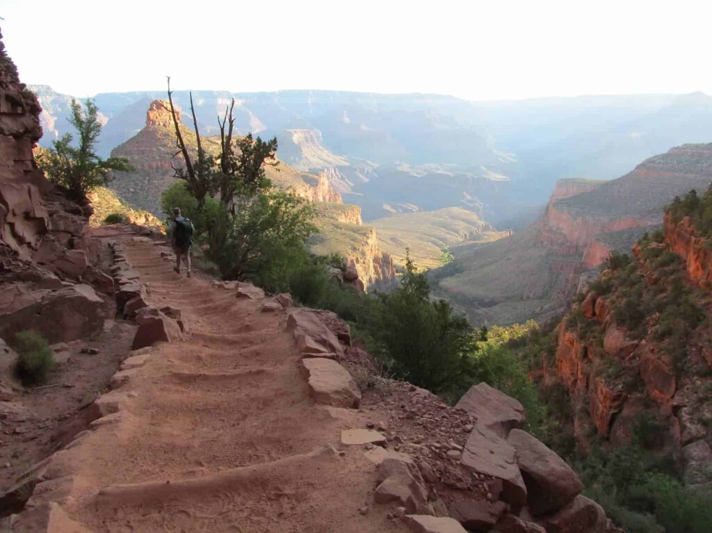
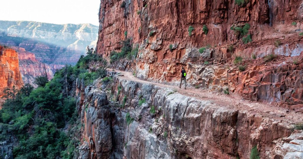
Bright Angel Trail
The most popular hiking trail into Grand Canyon, the Bright Angel Trail lets hikers walk in the footsteps of the canyon’s Indigenous Peoples, miners, and early tourists, as they descend into the canyon’s depths. Offering big views, morning and afternoon shade, resthouses, vault toilets, and drinking water during the summer, this trail offers an excellent first trip into the canyon.
Bright Angel Trail is considered the most popular hiking trail in the park. Well-maintained and graded for stock, it is fairly easy to walk down. This can be a blessing or a curse. Wide views of the inner canyon and distant formations often distract hikers from just how far down the trail they’ve walked. The return hike back up and out of the canyon is far more difficult and requires much more effort. Plan for at least twice as much time back up as it took to go down.
Echo Canyon Trail
Echo Canyon Trail is an Extremely Difficult, incredibly steep, very rocky, out-and-back trail that requires the assistance of handrails and other aides to reach the summit. To add to its extreme difficulty, Echo Canyon Trail is completely exposed to the elements, and offers very little shade and few places to rest. Starting as a relatively light trek, the trail quickly escalates to a strenuous climb that increases in difficulty as you ascend along the mountain’s western slope. As hikers approach the top of the trail it becomes less defined as you enter extremely rocky areas, and in certain sections hiking gives way to climbing. During winter and spring months, Echo Canyon experiences extremely high visitation. The parking lot will typically be full from late morning through early afternoon on weekdays, and remain full throughout the day on weekends. When the parking lot reaches capacity, the entry gate will be closed.
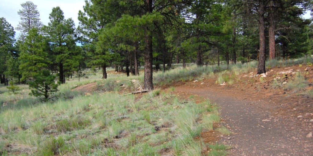
Campbell Mesa Trail
This popular trail system begins in large stands of old-growth ponderosa pine and Gambel oak. The various loops offer a wide variety of seasonal wildflowers, many examples of local birdlife, and frequent wildlife sightings. Visitors enjoy forested glades, broad interior meadows, and scenic views of Mt. Elden, Anderson Mesa and Mormon Mountain.
The system includes five loops. The longest, 5.7-mile Campbell Mesa Loop swings around the northern and eastern perimeter of the mesa, while Anasazi Loop shortcuts the west end of Campbell Mesa Loop to make a 2.7-mile sub-loop.
Continental Loop makes a short 1.8-mile tour to the northwest side of the mesa overlooking Walnut Canyon Lakes, Continental ball fields, and the course of the Rio de Flag. Sinagua Loop takes the shortest jaunt, just over a mile from the trailhead and back.
Walnut Meadows Loop swings 4 miles around the southwest end of the mesa, affording panoramas of Anderson Mesa on the far side of Walnut Canyon and distant Mormon Mountain. From Walnut Meadows Loop, a half-mile connector crosses Old Walnut Canyon Road to the Arizona Trail and Fisher Point.
All five loops of Campbell Mesa trail interconnect with each other and the Campbell Mesa trailhead.
Campbell Mesa lies within a non-motorized use area that provides solitude for visitors and shelter for wildlife. Walkers, hikers, cyclists, skiers, and snowshoers enjoy the trails in all seasons.
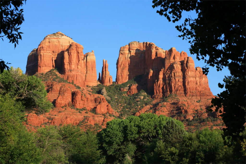
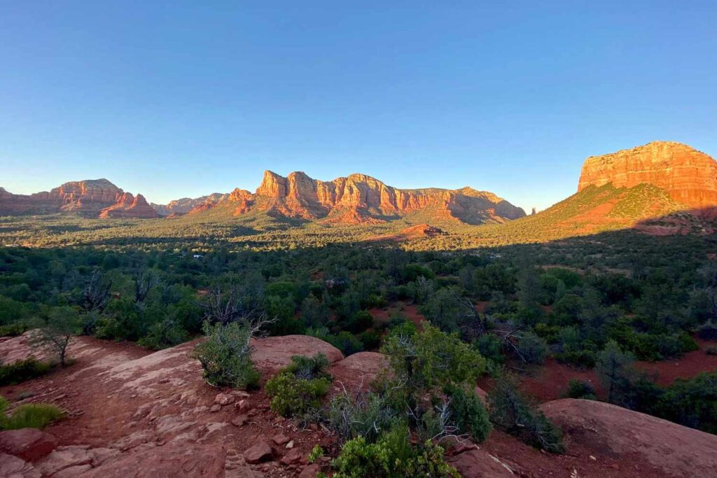
Cathedral Rock Trail
More of a rock climb than a hike, this trail is unshaded and steep and difficult in places. Follow the basket cairns across the wash and up the moderate slope toward the spires. At 0.25 mile, the trail emerges on a broad ledge with nice views. Then, it ascends steeply over bald rock and in a shallow cleft with a few toeholds notched into the rock to help on the steeper places.
Emerging on a small knob, cairns show the way up and across several ledges toward the deep drainage ahead which it follows, climbing moderately steeply to the top of a wide saddle between two spires. Great views all along, but quite spectacular from the top. An unmaintained path leads south along the west base of the spires giving access, with short climbs, to two more saddles between sheer rock faces and a close-up view of an exposed lava dike at the first. Return by the same route for a 1.5 mile hike. Hot in summer.
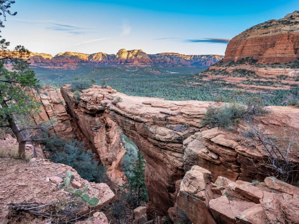
Devils Bridge Trail
Devil’s Bridge is a must-see on everyone’s Sedona bucket list. Formed by wind and weather erosion, it’s the largest natural sandstone arch in the Sedona area. As such, it is one of the busiest hiking trails in Sedona.
Devil’s Bridge is the largest natural sandstone arch in the Sedona area. Don’t let its name fool you: it’s one of the most heavenly sights in an area famous for them.
From a trailhead elevation of 4,600 feet, there’s a mere 400 foot climb in altitude during this moderately difficult, 1.8-mile roundtrip trek. The journey to reach the top won’t leave you breathless — but we would never say the same about the views you’ll witness when you finally get there.
This popular hike has attractions for both casual hikers who lack the desire or the stamina to stray too far from civilization, and the more adventurous outdoors enthusiasts. Starting at the parking area, follow the trailmarker that points the way to Devil’s Bridge Trail. You’ll find the early going effortless; the trail, originally built for jeep travel, is smooth and clear and leads you through washes filled with juniper and prickly pear cactus.
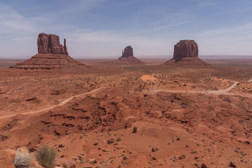
Wildcat Trail Monument Valley
The only official, maintained path is the 3.2 mile Wildcat Trail, a fairly level route that loops around West Mitten Butte so does at least allow for inspection of this rock from all angles, even if the surrounding landscape looks similar all along the one to two hour journey. The path lies within the popular Navajo Tribal Park (entrance fee $5), though as only a few people make the journey, the hike enables a quiet, solo appreciation of the scenery, in the company only of an unusually varied assortment of different species of lizards.
The Wildcat Trail begins just past the Navajo Tribal Park visitor center by the edge of a large, flat parking area at the edge of an escarpment, a site also used for picnics and primitive camping, and overlooking the hill at the start of the Valley View scenic drive – so a good place to observe small cars and large RVs descending slowly over the rough places near the start of the road. The first part of the path is also in view, winding a few hundred feet down a gently sloping hillside towards West Mitten Butte, about one mile away. East Mitten Butte and Merrick Butte are to the right, a mile or two further, and to the left are the wider cliffs of Sentinel Mesa, while the horizon in the far distance is largely featureless.
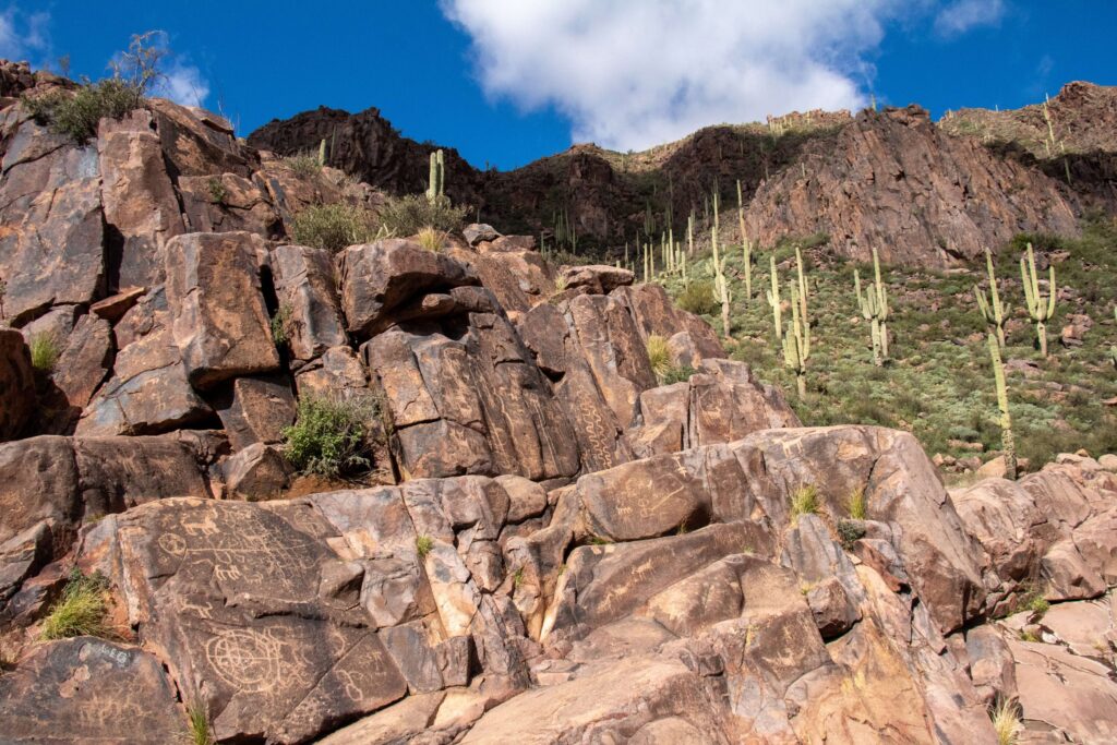
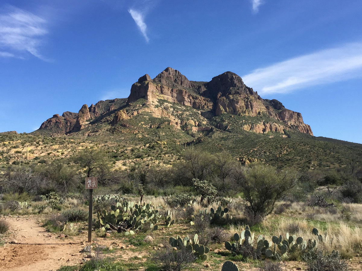
Hieroglyphic Trail
The 1.5 mile Hieroglyphic Trail climbs a gentle slope covered with many cacti then enters the lower end of a boulder-filled canyon, ending at a rocky section where pools persist for much of the year, a location important for the ancient Hohokam Indians, who inhabited this desert region up to 1,500 years ago. Evidence of their settlement includes hundreds of petroglyphs etched into the dark, weathered surface of the basalt cliffs above the pools, some with very intricate designs. This scenic location is high enough for a long-distance panorama southwest over Gold Canyon and the Gila River plain, and also provides close-up views of the jagged upper slopes of the Superstition Mountains to the north, rising over 2,000 feet higher.
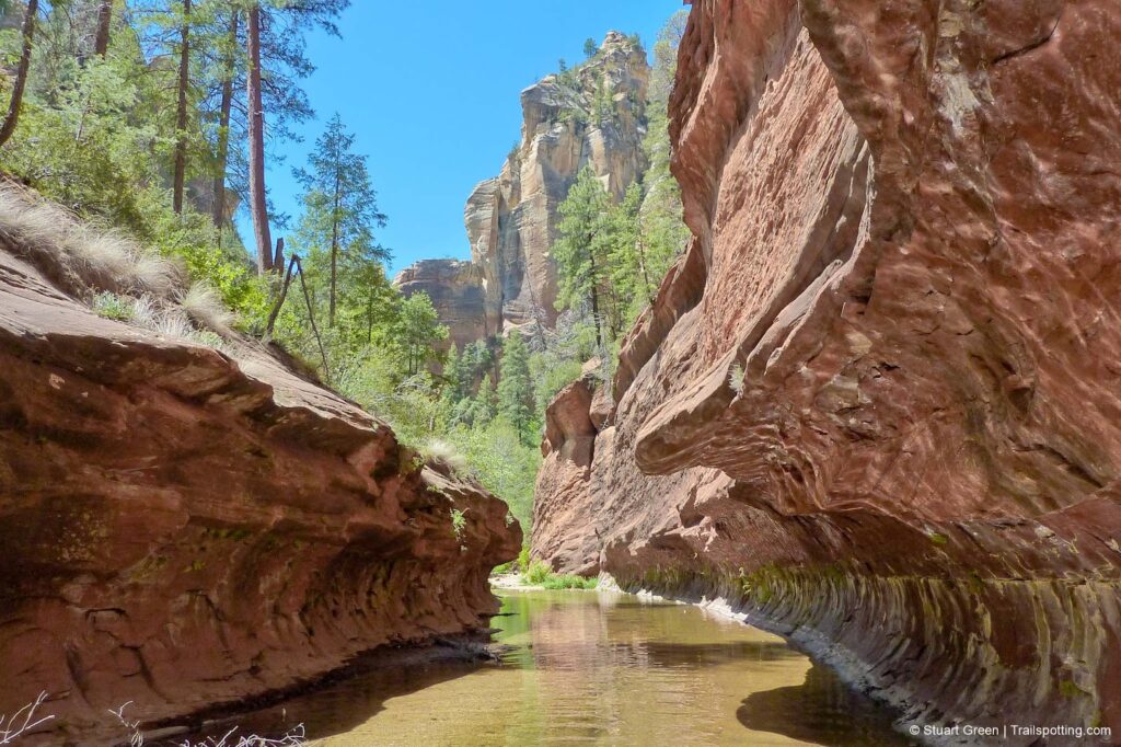
West Fork Trail
There are a number of reasons why West Fork is one of the most popular trails on the Coconino National Forest. Once you’ve strolled beside the pleasant little stream that ripples along the canyon floor and looked up, way up, at the dizzying cliffs that tower above it, you will fall in love with it, too. West Fork is fantastic throughout the year. In springtime, migrating songbirds decorate the trees with flashes of brilliance. In autumn, the canyon is ablaze with color, with red and gold leaves floating in clear reflecting pools under a canopy of solid color. In wintertime, icicles decorate from red rock overhangs, and snatches of snow persist in cool shadows. As a matter of fact, you’ll probably find a new reason to be here every time you visit.
As for the trail itself, it’s an easy stroll, but you do have to cross the stream in a number of places. Usually, that involves negotiating a few strategically placed stepping stones or taking a couple of steps in shallow water. The trail is marked and maintained for the first three miles.
The Rim Trail, Grand Canyon
Following the Grand Canyon’s edge is the Rim Trail, a 13-mile paved trail perfect for hiking or biking. The full length of the trail will take you from Hermit’s Rest, over the Grand Canyon Village’s main path, to the South Kaibab Trail Head. One of the park’s most scenic trails, the Rim Trail provides countless opportunities to view the canyon form several overlooks and viewpoints, perfect for taking striking pictures of the canyon. The 13-mile hike is also relatively easy, so don’t be daunted by its length, and instead focus on the many attractions that this path connects with including Hermit’s Rest, the Bright Angel Trailhead, Lookout Studios, and the Trail of Time. For an easy, relaxing, and adventure packed hike, you can’t go wrong with the scenic Rim Trail.
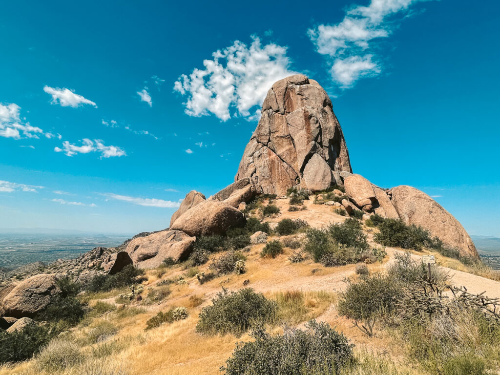
Tom’s Thumb Trail
Tom’s Thumb begins as a relatively flat walk through the desert but quickly begins to gain elevation after the first few minutes.
For the first mile, you’ll be hiking along a wide dirt path that allows hikers to simultaneously trek up and down the mountain. This part of the trail is the most challenging since you’ll be scaling the mountain, but the path is well-maintained, so you’ll be walking on gravel and won’t be required to step over any giant boulders.
Once you’ve finished the first mile, the trail will begin to level out, and you’ll start your hike into the mountain range. You’ll trek through tons of large boulders, dip into washes, and climb small hills. It’s tucked away inside the McDowell Mountains, so it’s a unique part of the hike with exciting features.
It gets a little rockier when you get to the trail’s end. Once you climb through the rocky portions of the trail, you’ll see Tom’s Thumb! There are plenty of boulders where you can rest, spot the parking lot you just climbed from, and admire your progress.
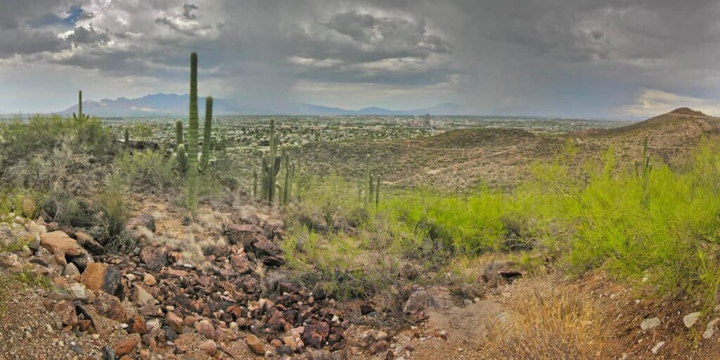
Tumamoc Hill, Tucson
Tumamoc Hill is one of the most popular hikes in Tucson thanks to its great city views, relatively short length, and night hiking opportunities. The route is paved, which is a plus for hikers who prefer or require even footing. Because Tumamoc Hill is on university property, it’s the only hike in the Tucson Mountain Range that is open for night hiking. If you want to watch the sunset or sunrise, this is the place to be!
The route is 5.0 km long, but some hikers turn around at the midpoint instead of going the entire way. Expect a 2 m paved route with plenty of signage. Some parts of the trail are steep, which could make using a stroller or wheelchair very difficult without some assistance. Overall we rate this trail as moderately difficult. If you come in hot weather, please ensure you’ve got lots of hydration and some sun protection with you.

Picketpost Hike, Superior
Even for experienced hikers, Picketpost Mountain is about as much of an adventure you’ll find in the area.
The reward is spectacular, 360-degree views of the Superstition Mountains and other ranges, and a photo op with the iconic red mailbox at the trail’s summit.
The 2-mile ascent is mostly steep and very rocky. Expect some scrambling if you stay on the trail, and more if you don’t. Look for cairns (stacked rocks) for guidance if you’re unsure which direction the trail is headed.
The trail gets trickier as you near the summit, so look out for blue spray-painted arrows that lead the way. While helpful, keep in mind that these are actually vandalism, so please don’t add your own.
When the climb eventually mellows, you’re home free. The last 5-10 minutes of the ascent is an easy-to-follow dirt trail on a slight incline, enveloped by lush prickly pears and century plants.
At the summit you can write a note or leave a gift to future hikers inside the mailbox. There’s room for two on a metal bench, where you can rest for a snack or just take in the views. It’s just as easy to get lost on the descent. Stray too far toward the rock wall and you’ll be forced to slide down a dry wash or two. This can be exhilarating or perilous — especially if there’s ice — but often quicker than finding another way to climb down. You can take comfort in some of these non-routes, though. There are cairns dotting paths that could work, meaning at least someone has done it before and presumably lived.


Inside Arizona 2023 | All Rights Reserved.