We use cookies to help you navigate efficiently and perform certain functions. You will find detailed information about all cookies under each consent category below.
The cookies that are categorized as "Necessary" are stored on your browser as they are essential for enabling the basic functionalities of the site. ...
Necessary cookies are required to enable the basic features of this site, such as providing secure log-in or adjusting your consent preferences. These cookies do not store any personally identifiable data.
Functional cookies help perform certain functionalities like sharing the content of the website on social media platforms, collecting feedback, and other third-party features.
Analytical cookies are used to understand how visitors interact with the website. These cookies help provide information on metrics such as the number of visitors, bounce rate, traffic source, etc.
Performance cookies are used to understand and analyze the key performance indexes of the website which helps in delivering a better user experience for the visitors.
Advertisement cookies are used to provide visitors with customized advertisements based on the pages you visited previously and to analyze the effectiveness of the ad campaigns.
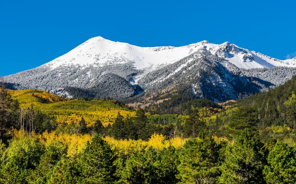
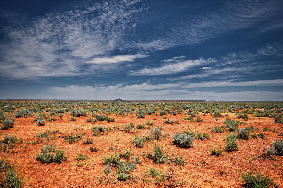
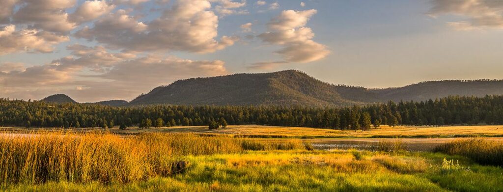
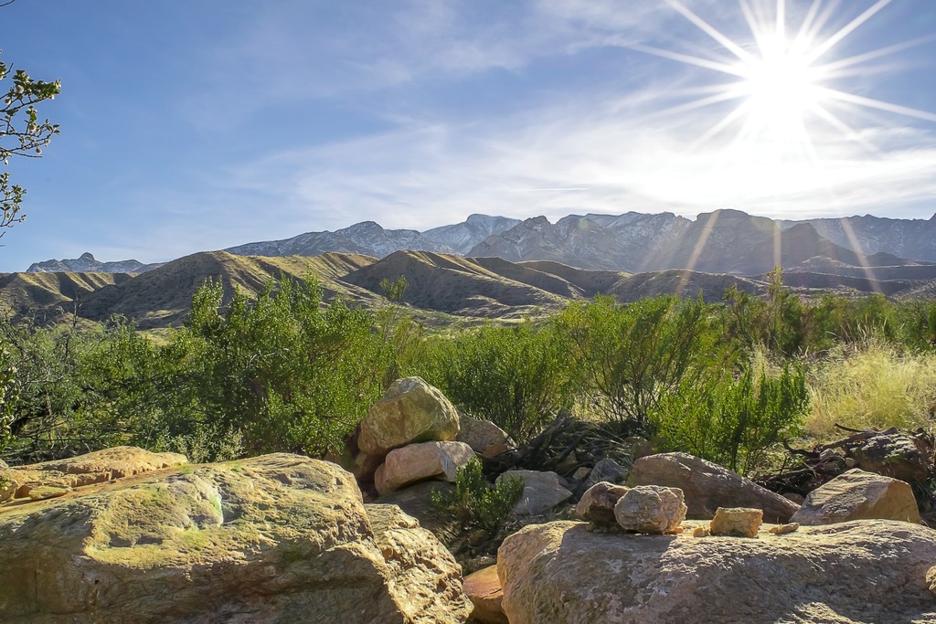
People not familiar with the state assume that Arizona is mostly flat desert, or at best stately spires of rock in a desolate landscape. Arizona is home to many tall mountains!
There are 9 mountains in Arizona that have an elevation greater than 10,000 feet!
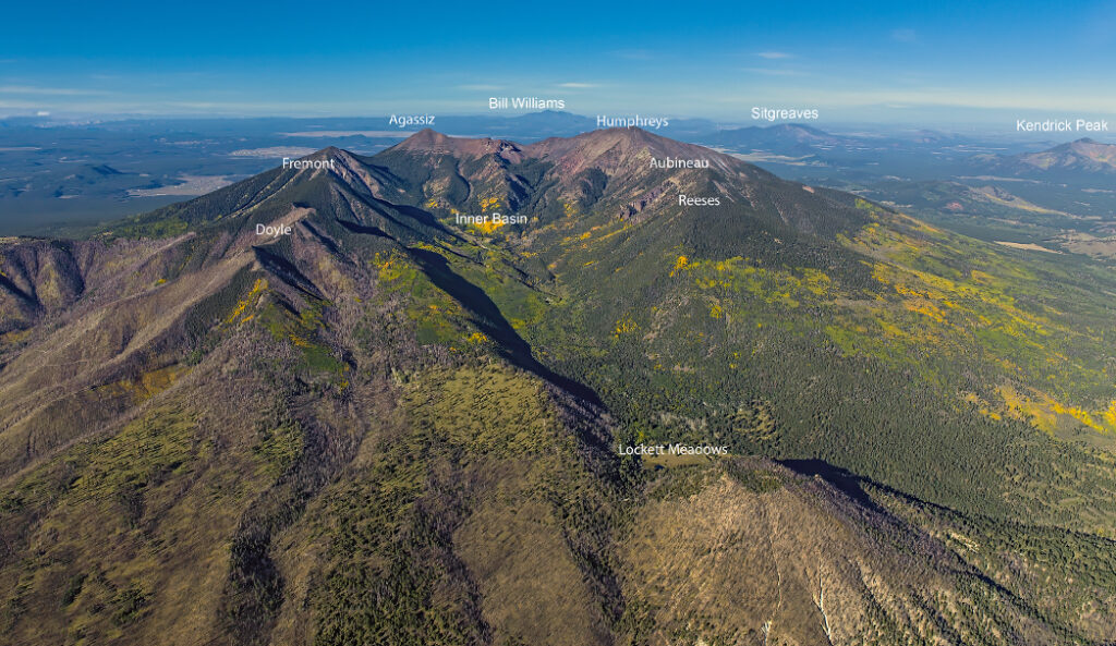
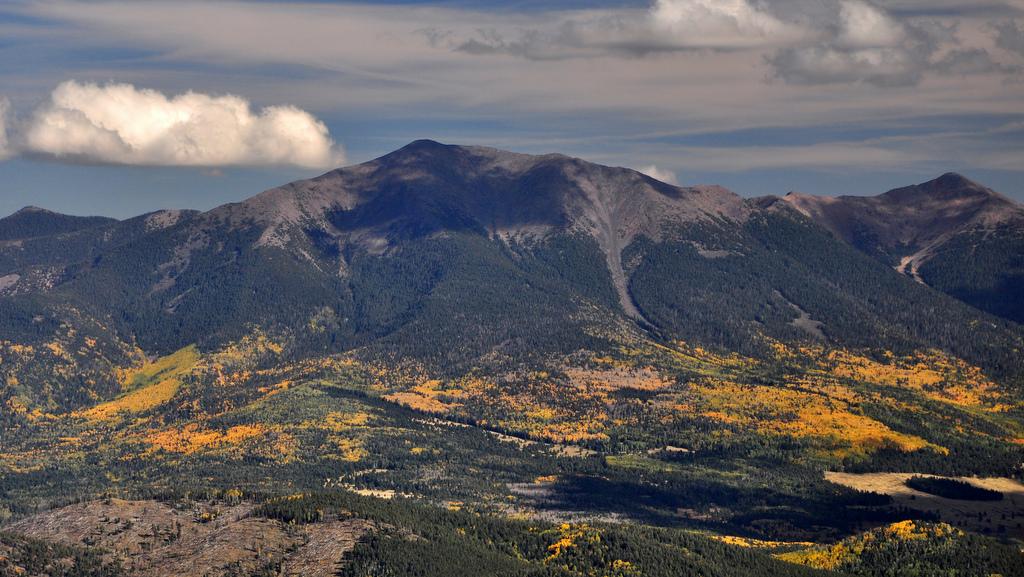
In the 1500s, the Spanish Conquistadors explored the area searching for gold and came upon the peaks and named them “Sierra Sinagua” meaning Mountains Without Water. The name didn’t stick, because they left the area quickly in search of the Grand Canyon and other gold. In 1629, Franciscan Friars who were conducting missionary work with Natives of the area named the mountain “San Francisco Peak” in honor of Patron Saint Francis of Assisi. In 1853 a man by the name of Amiel Whipple, who was leading expeditions in the area to find possible routes for a railroad across the continent dubbed the mountain range “San Francisco Cone,” but that name was never official and early maps still had the mountain printed as “San Francisco Peak.” On many maps today, the official name is printed as “San Francisco Mountain,” but many people either call it “The Peaks” or “San Francisco Peaks.”
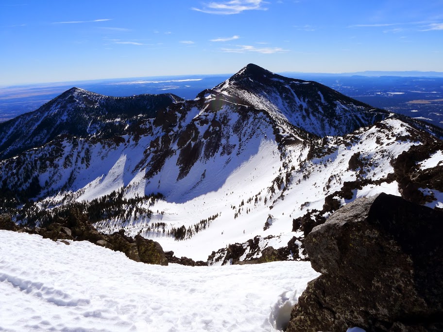
Humphrey’s Peak 12,637
Humphreys Peak is the highest natural point and the second most prominent peak after Mount Graham in the U.S. state of Arizona, with an elevation of 12,637 feet and is located within the Kachina Peaks Wilderness in the Coconino National Forest, about 11 miles north of Flagstaff, Arizona. Humphrey’s Peak was named by G. K. Gilbert in 1873 after his superior officer Brig. Gen. Andrew Atkinson Humphreys. Humphreys had been a captain with the Ives Expedition in 1851 and evaluated the survey data of several expeditions that attempted to find routes for wagon roads and a railroad through the region. He later became Chief of the Army Corps of Topographical Engineers.
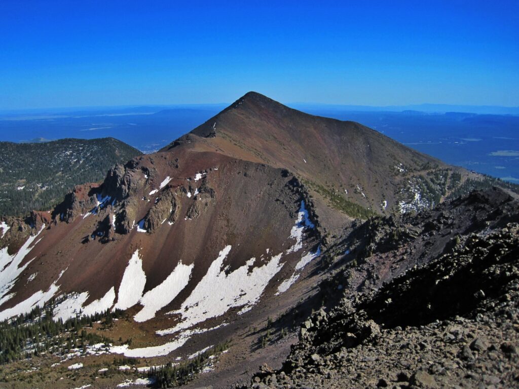
Agassiz Peak 12,356
Agassiz Peak is the second-highest mountain in the U.S. state of Arizona at 12,360 feet. It is located north of Flagstaff, Arizona in the San Francisco Peaks. It is in the Kachina Peaks Wilderness on the Coconino National Forest. Agassiz Peak was named in 1867 after the famous Swiss zoologist of Harvard University, Jean Louis Rodolphe Agassiz (1807-1873), who made a fossil study during the Pacific Railroad survey through the area. It was named by Gen. W. J. Palmer during the survey as he crossed the area directly south of the mountain. He decided to change the name to Mt. Agassiz “for distinction” purposes. This became Agassiz Peak.
Fremont Peak 11,973
Fremont is Arizona’s 3rd highest mountain. Fremont Peak is a peak in the San Francisco Peaks, a mountain range that takes up a part of the Coconino National Forest in northern Arizona. Fremont Peak was named after John Charles Fremont (1813-1890), the “Pathfinder of the West,” who began searching for an overland route to the Pacific in 1842. He was also a general in the Mexican War and the Civil War, as well as served as the territorial governor of Arizona from 1878-1882
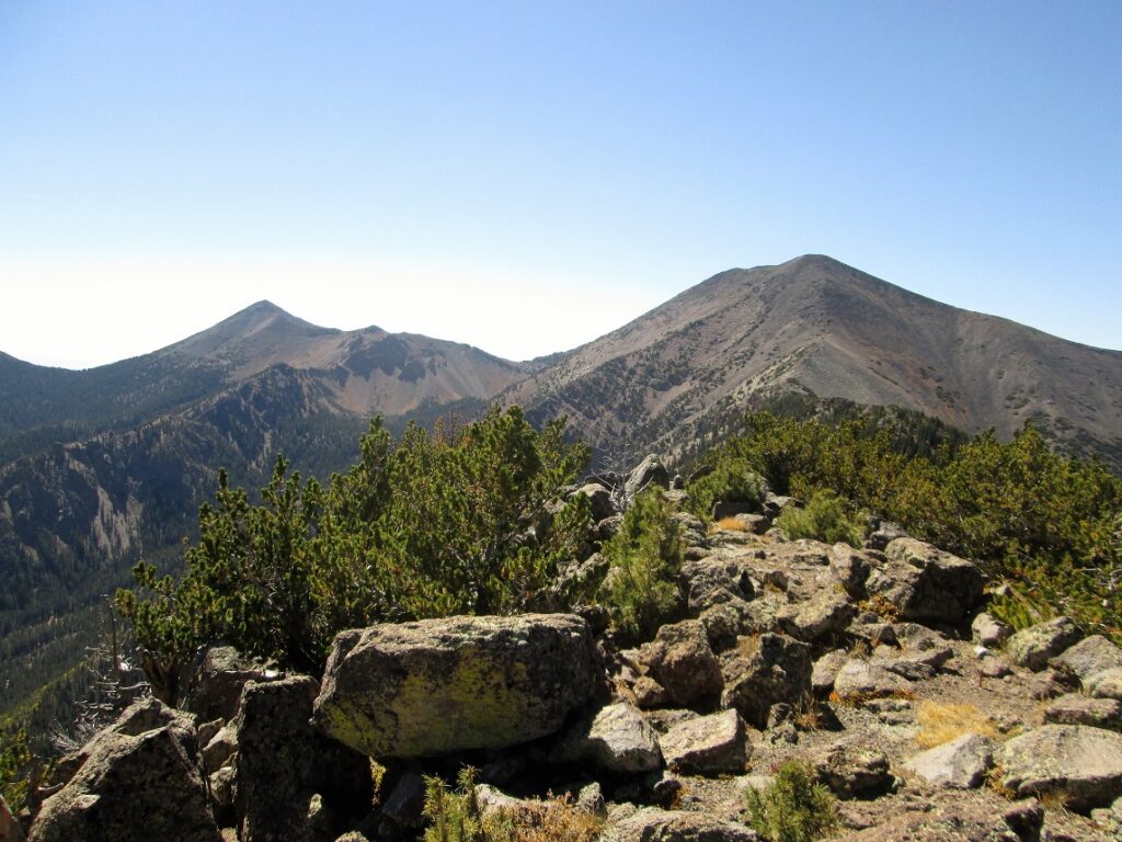
Aubineau Peak 11,818
Abineau Peak was named for Julius Aubineau (1852-1903) who was a prominent person in the early years of Flagstaff’s development. He was a native of France who was trained as an engineer and served as a lieutenant in the Franco-Prussian War. He came to Flagstaff in 1891 and received his citizenship in 1894. He actually was the mayor of Flagstaff in 1898, but resigned that same year over a disagreement allowing houses of prostitution in the main town area. His connection with the Peaks involved his ownership of Aubineau Spring and his role in the development of the Inner Basin water system. He engineered the route for the Inner Basin waterline and Waterline Road in 1898, built the first sewage system to serve the town businesses in 1899, and filed for water rights on the Inner Basin Springs and Schultz Pass in 1900.
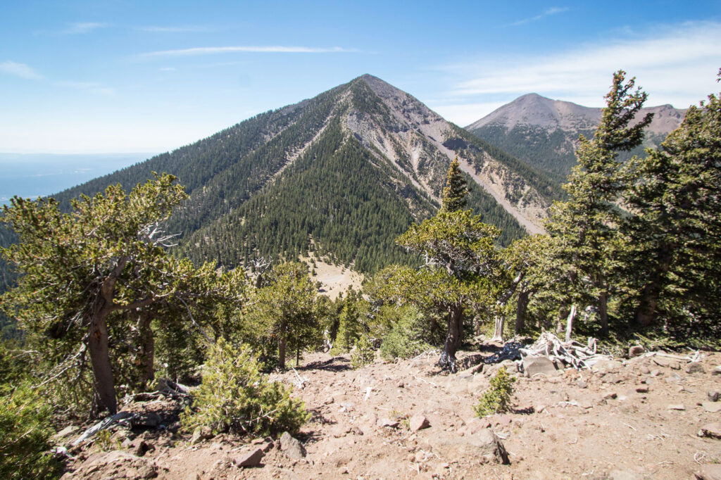
Doyle Peak 11,464
Doyle Peak, and Doyle Saddle, which connects Agassiz and Fremont Peaks, were named in 1933 by Dr. Harold S. Colton, founder of the Museum of Northern Arizona, for Allen Doyle (1850-1920), a cattleman and guide. Doyle went to Prescott as a miner and drove cattle from there to Flagstaff in 1881. He stayed in the Flagstaff area to become famous as a guide for many notables, including Zane Grey, the famous author of many western novels.
Mount Baldy 11,409
Mount Baldy is one of the most sacred mountains to the Apache of Arizona. The Western Apache of Arizona inhabited the areas within their four most sacred mountain ranges: the White Mountains of Eastern Arizona, the Pinaleno Mountains near the town of Safford in southeastern Arizona, the Four Peaks near the City of Phoenix and the San Francisco Peaks near Flagstaff. Mount Baldy also contains the headwaters of the Little Colorado River and Salt River and produces the most abundant trout fishing streams in Arizona. No other mountain in Arizona produces as many rivers and streams. Along its slope are numerous man made lakes. The area around Mount Baldy also averages the most abundant precipitation in Arizona. Wildlife is abundant on the mountain and includes the recently introduced Mexican Grey Wolf.
Escudilla Mountain 10,916
Escudilla Mountain is located in Apache County, Arizona, and is part of the White Mountains. The peak is approximately 3.5 miles from the Arizona-New Mexico border. The summit is the highest point in the Escudilla Wilderness which is administered as part of the Apache-Sitgreaves National Forest.
Mount Graham 10,724
Mount Graham is the tallest of southeastern Arizona’s sky islands—mountain ranges that rise like forested islands out of a desert sea. Ascending this mountain is the ecological equivalent of traveling from Mexico to Canada. Varied biotic communities, layered in life zones, provide ideal habitat for a diverse array of plants and animals, including endemic species found nowhere else in the world. The uppermost life zone is home to relic species from the last ice age, including the southernmost stand of Englemann spruce in the United States. High elevation meadows, cool forests, groves of aspen, and perennial streams make for an enchanting escape from the Sonoran and Chihuahuan Deserts below
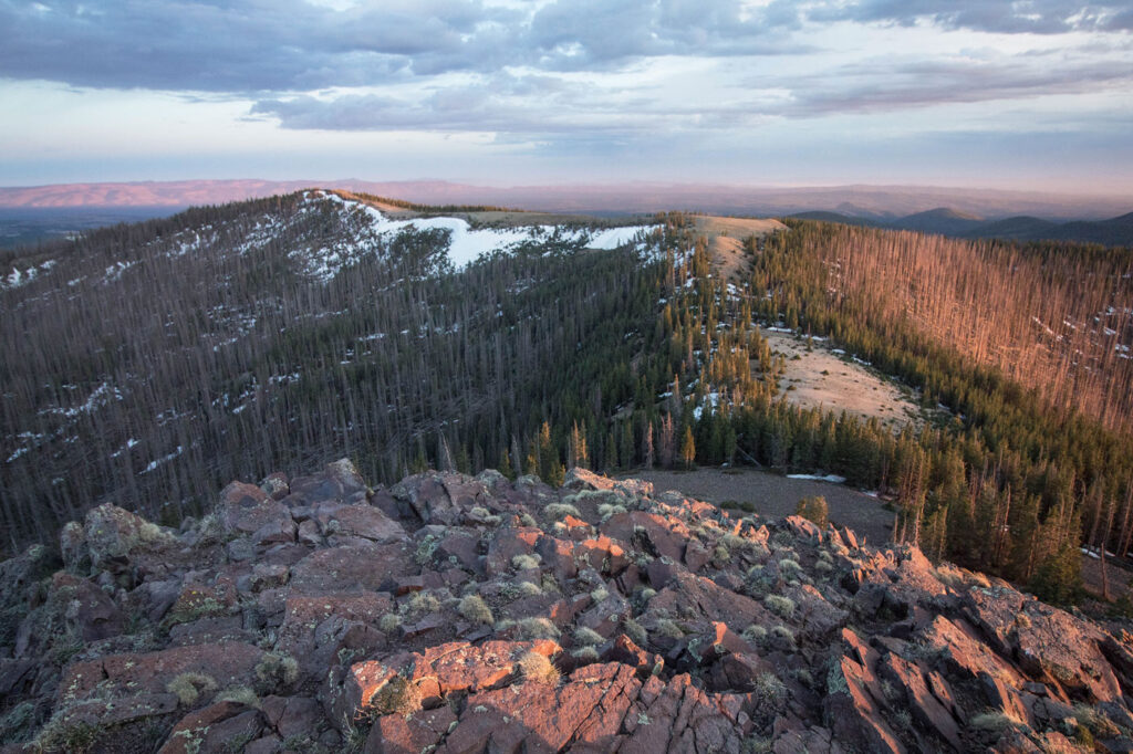
Kendrick Peak 10,420
Kendrick Peak or Kendrick Mountain is one of the highest peaks in the San Francisco volcanic field north of the city of Flagstaff in the U.S. State of Arizona and is located on the Coconino Plateau in Coconino County. There are three maintained trails to the summit of Kendrick Peak – Kendrick Mountain Trail, Pumpkin Trail and Bull Basin Trail. Along the Kendrick Mountain Trail, near the summit of Kendrick Peak, there is a Colorado Pinyon growing at an altitude of nearly 10,400 ft. This is a rare high-elevation example of this species growing amongst Engelmann spruce and limber pine.


Inside Arizona 2023 | All Rights Reserved.