We use cookies to help you navigate efficiently and perform certain functions. You will find detailed information about all cookies under each consent category below.
The cookies that are categorized as "Necessary" are stored on your browser as they are essential for enabling the basic functionalities of the site. ...
Necessary cookies are required to enable the basic features of this site, such as providing secure log-in or adjusting your consent preferences. These cookies do not store any personally identifiable data.
Functional cookies help perform certain functionalities like sharing the content of the website on social media platforms, collecting feedback, and other third-party features.
Analytical cookies are used to understand how visitors interact with the website. These cookies help provide information on metrics such as the number of visitors, bounce rate, traffic source, etc.
Performance cookies are used to understand and analyze the key performance indexes of the website which helps in delivering a better user experience for the visitors.
Advertisement cookies are used to provide visitors with customized advertisements based on the pages you visited previously and to analyze the effectiveness of the ad campaigns.


Glen Canyon Dam is a concrete arch-gravity dam in the southwestern United States, located on the Colorado River in northern Arizona, near the city of Page. The 710-foot-high (220 m) dam was built by the Bureau of Reclamation (USBR) from 1956 to 1966 and forms Lake Powell, one of the largest man-made reservoirs in the U.S. with a capacity of more than 25 million acre-feet (31 km3). The dam is named for Glen Canyon, a series of deep sandstone gorges now flooded by the reservoir; Lake Powell is named for John Wesley Powell, who in 1869 led the first expedition to traverse the Colorado River Grand Canyon by boat.
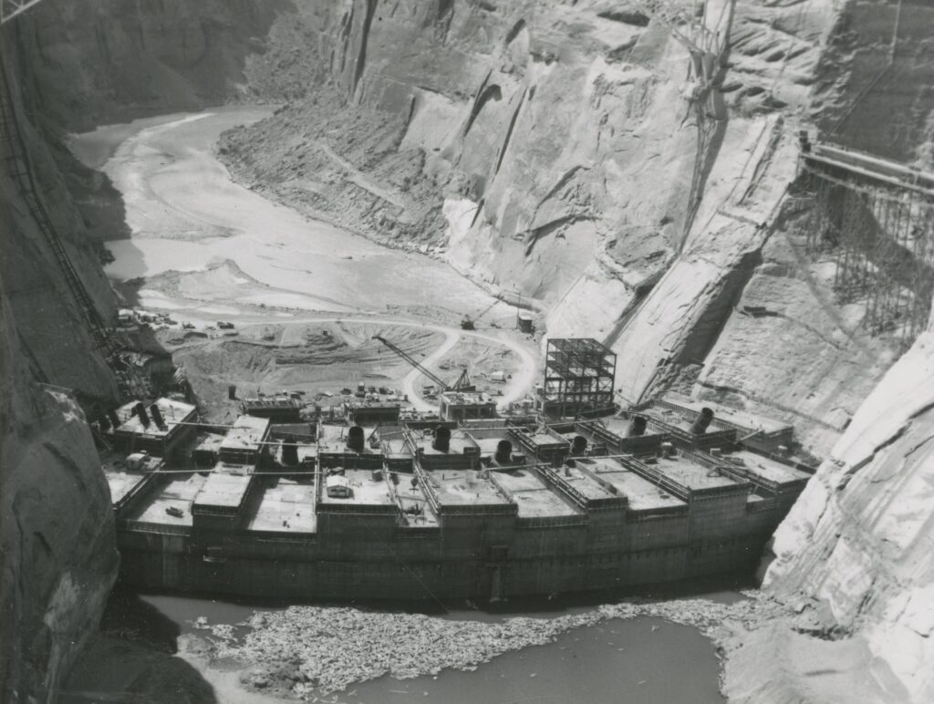
In 1956, work began on the two diversion tunnels that would carry the Colorado River around the dam site during construction. Each of the tunnels was 41 feet (12 m) in diameter, with a combined capacity of 200,000 cubic feet per second (5,700 m3/s); the right-side tunnel was 2,740 feet (840 m) long and the left 2,900 feet (880 m). The right tunnel would be used for carrying the Colorado’s normal flow around the dam site, while the left tunnel, 33 feet (10 m) above the water, would only be used during floods. The lower reaches of the tunnels would later be used to form the lower ends of the dam’s spillways. About 182,000 cubic yards (139,000 m3) of material would have to be excavated from the diversion tunnels.
On October 15, 1956, President Dwight D. Eisenhower pressed a button on his desk in Washington, D.C., sending a telegraph signal that set off the first blast of dynamite at the portal of the right diversion tunnel. Drilling the tunnels through the porous Navajo sandstone abutting the dam site posed major problems for the excavation crews of the Mountain States Construction Company, which won the contract for the diversion tunnels in 1956. Transporting workers and equipment to the bottom of the canyon was extremely difficult. Initially, transport was done by barge from Wahweap Creek, but the fast current of the Colorado River could be dangerous. After a barge capsized, spilling tons of machinery into the river, a much safer cable-car system was installed. During excavation, the rock frequently broke apart or “slabbed” and collapsed into the tunnels, and metal bolts had to be drilled into the rock to secure it. The largest such event, on August 5, 1958, sent 5,200 cubic yards (4,000 m3) crashing down onto the upper portal of the left diversion tunnel.

It took more than 17 years for Lake Powell to finally reach its full elevation of 3,700 feet (1,100 m) above sea level, which it crossed on June 22, 1980. One of the main reasons for this slow rise, in addition to the need to meet obligations to the Lower Basin, was the leakage of vast amounts of water into the porous Navajo Sandstone aquifer. Between 1963 and 1969, as much as 655,000 acre-feet (0.808 km3) leaked into the reservoir banks each year. Conversely, some of this “bank storage” flows back into the reservoir as springs and seeps when Lake Powell is low. Exactly how much of this water has potential to return to the reservoir, and how much “disappears” into the ground, is subject to debate.
With a capacity of 25,160,000 acre-feet (31.03 km3), Lake Powell is the second largest man-made lake in the United States by total water capacity (after only Lake Mead), extending 186 miles (299 km) upstream through the canyons of Arizona and Utah. The lake covers 161,390 acres (65,310 ha) at its full pool elevation of 3,700 feet (1,100 m). The active, or useful capacity is 20.876 million acre-feet (25.750 km3). The minimum water level required for power generation is 3,490 feet (1,060 m), corresponding to storage of 4.0 million acre-feet (4.9 km3), and the “dead pool”, the lowest point at which water can be released through the dam, is 3,370 feet (1,030 m) with storage of 1.9 million acre-feet (2.3 km3).[123] When Glen Canyon Dam was first built, the reservoir capacity was estimated at 28.04 million acre-feet (34.59 km3), but some of this has since been lost to siltation. Because of the hundreds of bays and sinuous side canyons, including those formed by the San Juan, Escalante and Dirty Devil Rivers, Lake Powell has an exceptionally long shoreline for a lake of its size – about 1,960 miles (3,150 km) at full pool, longer than the entire west coast of the continental United States
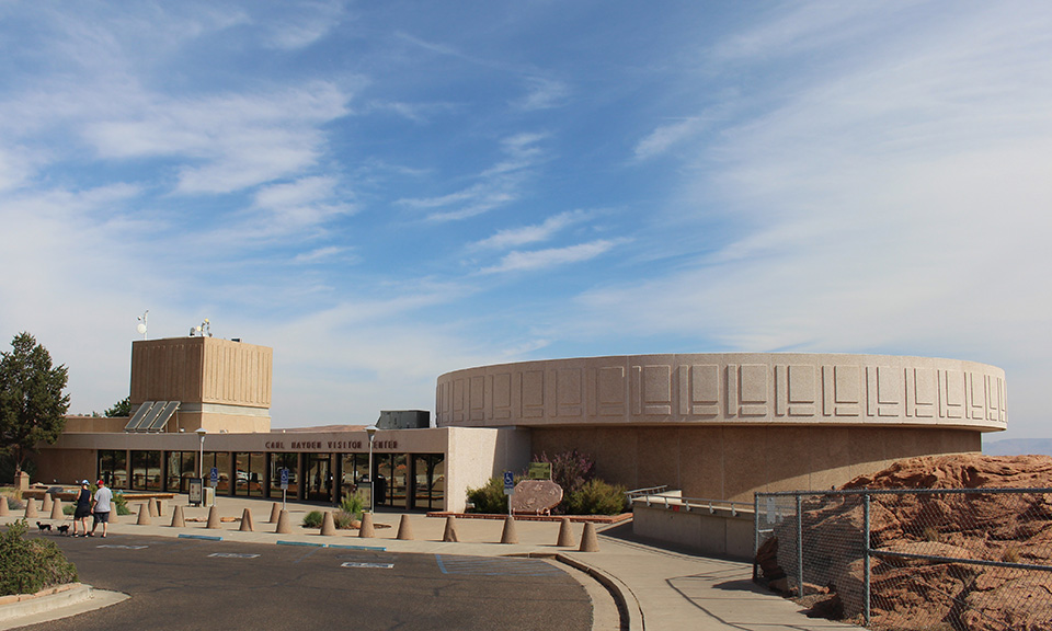
The Carl Hayden Visitor Center at Glen Canyon Dam is located on the west end of the dam, approximately 110 feet above its crest. This beautiful, modernistic building whose circular, glass-enclosed east end juts out over the dam, provides a sweeping panoramic view of the dam and Lake Powell behind it.
Completed in 1963, the Visitor Center was built to acquaint and inform the many visitors who flocked to Lake Powell. It now accommodates over a million visitors a year who come here from all over the world. In this day and age of high energy costs and government waste, the Carl Hayden Visitor Center is actually a great example of energy efficiency as a result of retrofits made in 1994 and 1995.
When visiting Lake Powell, this should be at the top of your list of things to do. If you are limited on time, at least take the self-guided tour. There are wonderful exhibits, photographs, dioramas and a beautiful relief map of the dam, Lake Powell and the surrounding area. As you view these photographs and exhibits, it is like a taking a time capsule back to the past.


Inside Arizona 2023 | All Rights Reserved.