We use cookies to help you navigate efficiently and perform certain functions. You will find detailed information about all cookies under each consent category below.
The cookies that are categorized as "Necessary" are stored on your browser as they are essential for enabling the basic functionalities of the site. ...
Necessary cookies are required to enable the basic features of this site, such as providing secure log-in or adjusting your consent preferences. These cookies do not store any personally identifiable data.
Functional cookies help perform certain functionalities like sharing the content of the website on social media platforms, collecting feedback, and other third-party features.
Analytical cookies are used to understand how visitors interact with the website. These cookies help provide information on metrics such as the number of visitors, bounce rate, traffic source, etc.
Performance cookies are used to understand and analyze the key performance indexes of the website which helps in delivering a better user experience for the visitors.
Advertisement cookies are used to provide visitors with customized advertisements based on the pages you visited previously and to analyze the effectiveness of the ad campaigns.
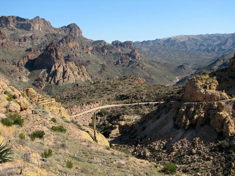
The views are amazing and for 40 miles it can take a few hours as the speed limits are very slow. This trip rates pretty high on my NopeMeter back in the day before they at least put a few guard rails in. A 9 mile section of the road has been closed but you can access the majority of the road either from Apache Junction or Roosevelt Lake.
The Apache Trail in Arizona was a stagecoach trail that ran through the Superstition Mountains. It was named the Apache Trail after the Apache Indians who originally used this trail to move through the Superstition Mountains.
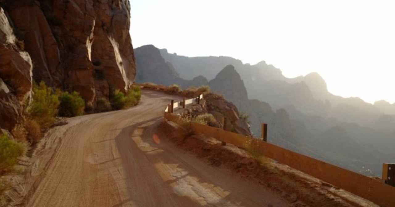
The Apache Trail, known more officially as Arizona State Route 88, is a 40-mile drive starting in Apache Junction and ending at Theodore Roosevelt Dam. The road is very winding, with switchbacks and sharp turns, so drivers should take caution. Once you reach the trail’s end, you can either turn around and go back the way you came or continue onto the circle route, which takes you back through Globe.
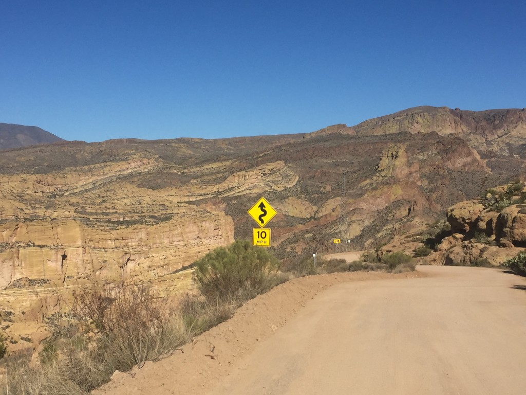
It’s important to note that the trail is only partially paved but well-maintained. Any reliable vehicle should be able to make the drive, but RVs are heavily discouraged beyond Tortilla Flat.
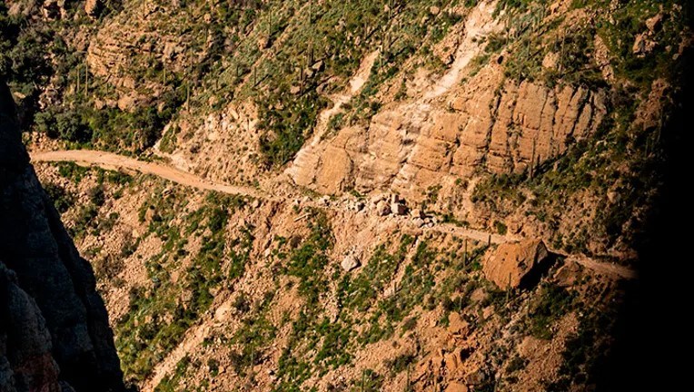
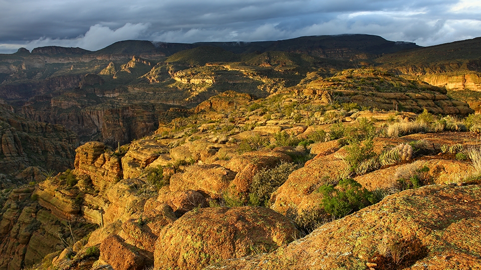
The drive from Tortilla Flat up to the Fish Creek Hill Viewpoint is quite challenging but very scenic. You’ll likely want to stop at the viewpoint for dramatic photos of the Sonoran Desert vistas. Beyond Fish Creek Hill, you’ll start a steep decline down to the canyon floor. RVs and large trailers are strongly discouraged, and this portion of the Apache Trail is not for the faint of heart. A section of the trail was damaged in a storm and resulting rockfall a few years ago, it is still not been repaired.

The majority of the road that is unpaved is very narrow, especially for 2 way traffic. The guard rails are a new edition, there aren’t many!
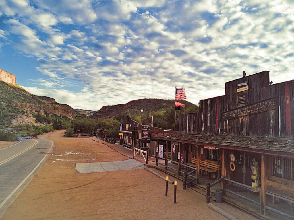
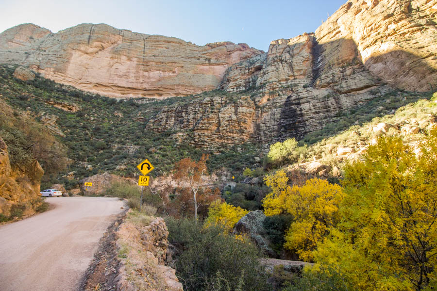
Nestled deep in the Superstition Mountains in the Arizona Sonoran Desert sits Tortilla Flat. Back in 1904, it was established as a town and stagecoach stop. Over the past century, the town has faced devastating fires and floods, each time, rebuilding. As a favorite for family day trips in Arizona, it is also a destination for global tourists, offering a unique small town experience and one of the best family day trips in Arizona for eating, drinking, shopping, and exploring the history and legends of the Tonto National Forest, Apache Trail, and the Lost Dutchman’s Gold. The drive from Apache Junction rates a 10/10 for motorcycles, so be sure to keep your eyes out for them when you go.
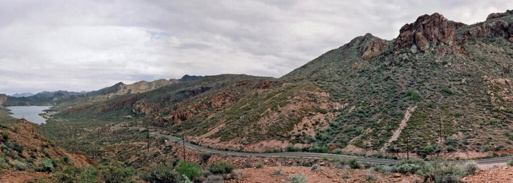
The scenic byway was designated in 1998, and is approximately 39 miles long, winding in and out of some of the most awe-inspiring country in Arizona–or for that matter, in the West. It is bound on the north by Canyon and Apache lakes, and on the south by the rugged Superstition Mountains and the Superstition Mountain Wilderness Area.
Sections of State Route 88 (Apache Trail) are closed pending further notice. Open to traffic: Apache Junction (milepost 194) to Fish Creek Overlook/Rest Area (milepost 220) Closed to traffic indefinitely: Fish creek Hill Overlook/Rest Area (milepost 220) to Apache Lake Marina (Milepost 229) Open to traffic: Apache Lake Marina (milepost 229) to Roosevelt (milepost 242)


Inside Arizona 2023 | All Rights Reserved.